Excited to be now able to offer my aerial photography clients Ortho Mosaic Aerial Photography
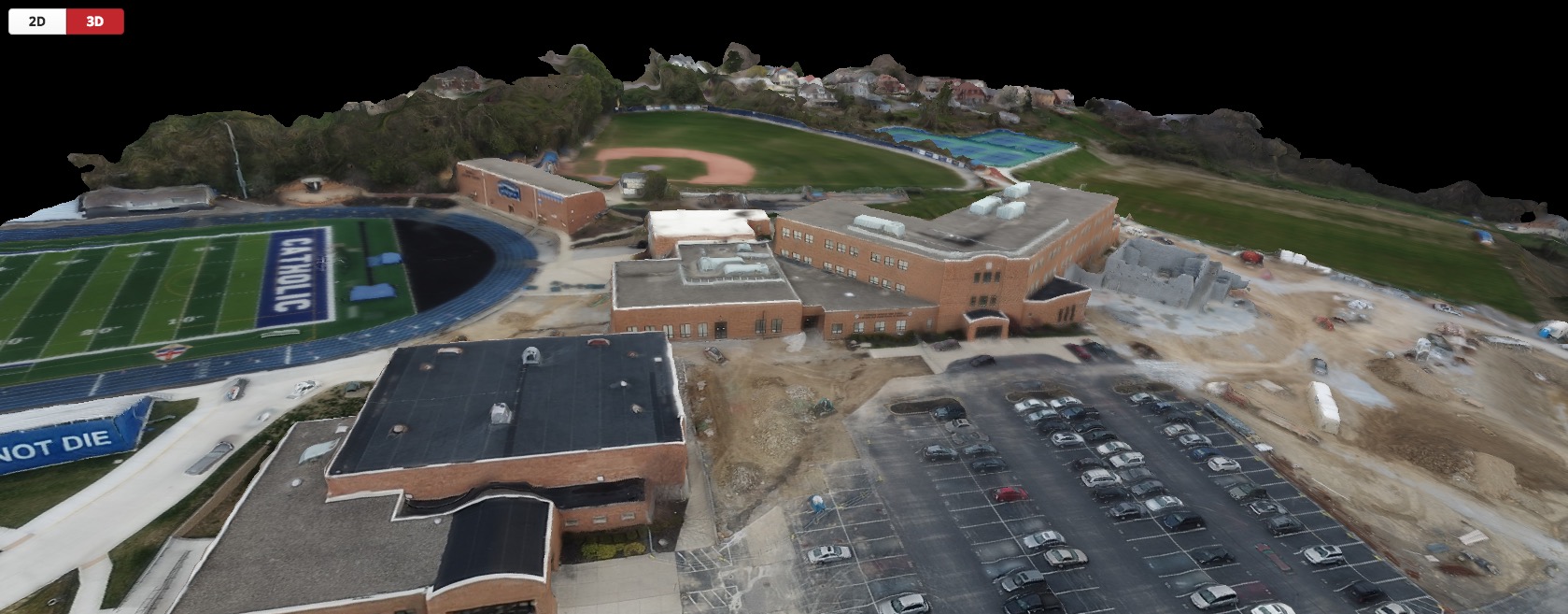
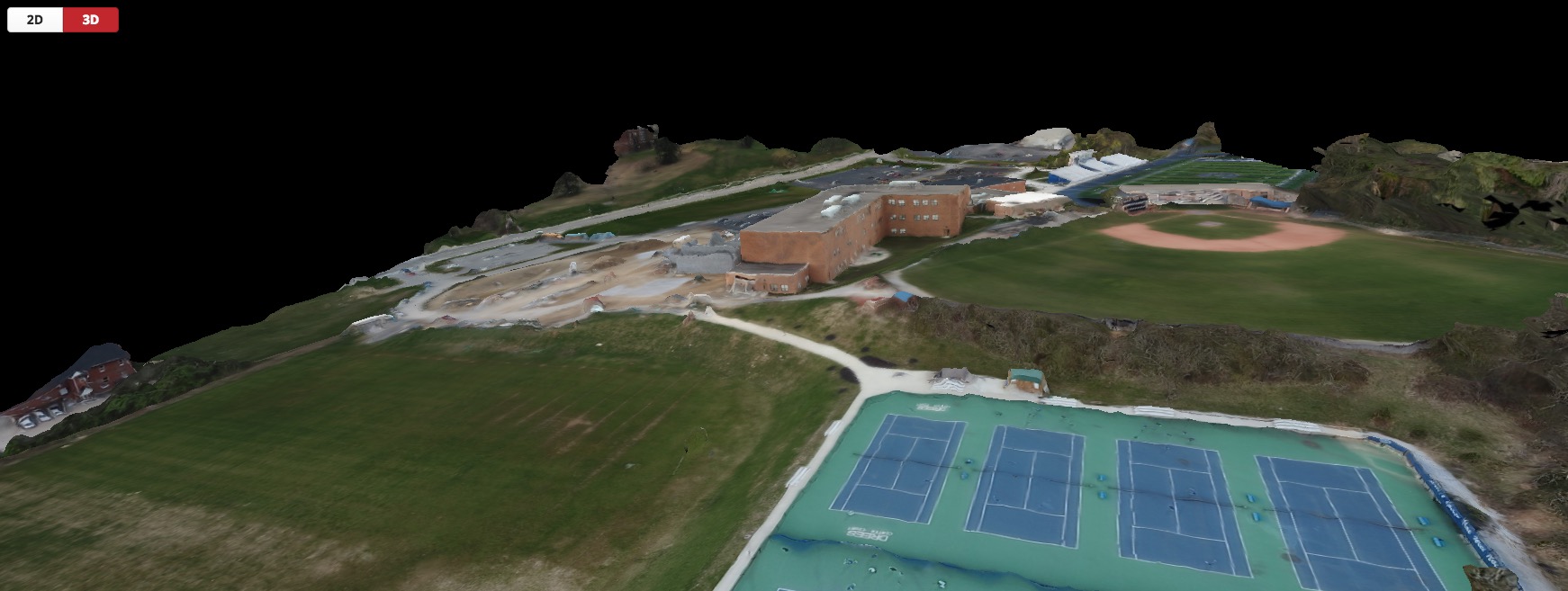
We can now generate Ortho mosaic Maps, Digital Elevation Models, aerial 3D models, point clouds and digital surface models (DSM) from aerial data.
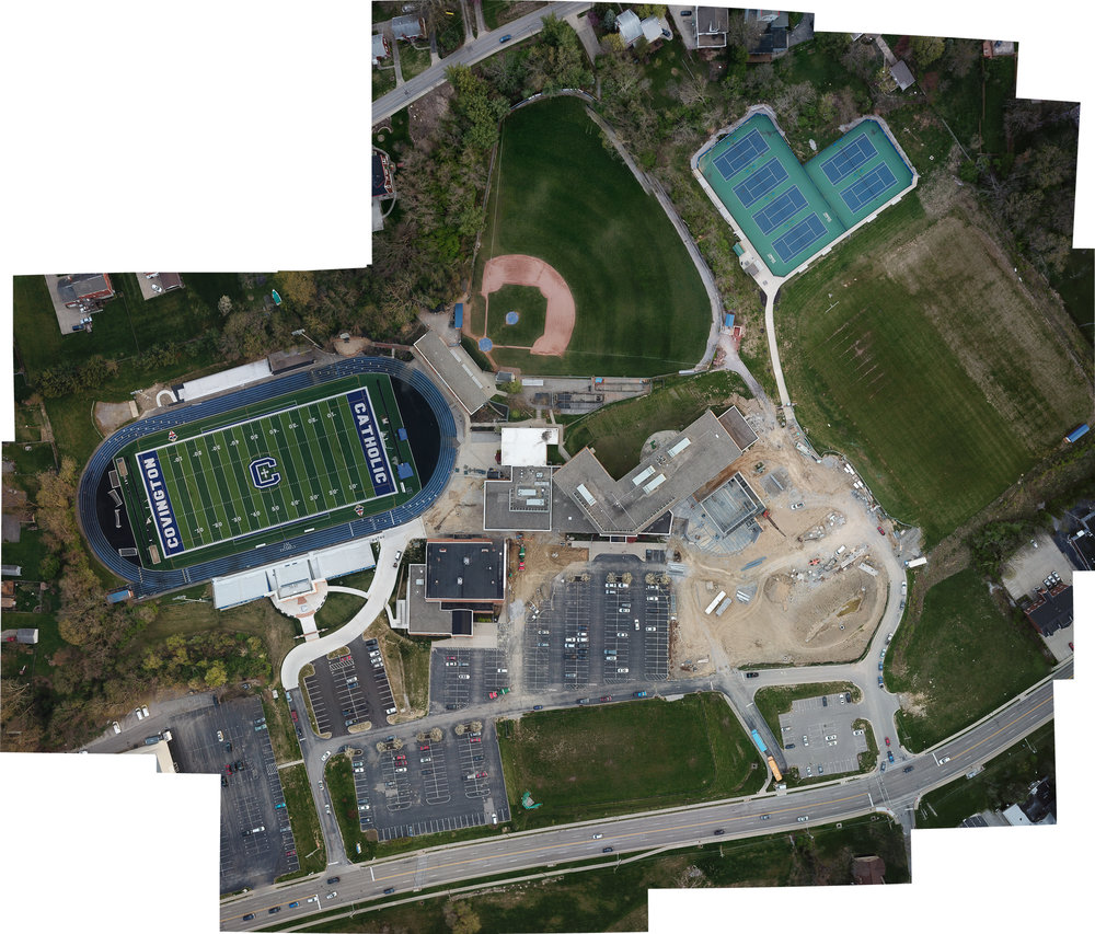
For those who aren’t familiar, an ortho mosaic, orthophoto, orthophotograph or orthoimage is an aerial photograph geometrically corrected (“orthorectified”) such that the scale is uniform: the photo has the same lack of distortion as a map. Unlike an uncorrected aerial photograph, an orthophotograph can be used to measure true distances, because it is an accurate representation of the Earth’s surface, having been adjusted for topographic relief, lens distortion, and camera tilt.
Put simply, an orthomosaic map is a detailed, accurate photo representation of an area, created out of many photos that have been stitched together and geometrically corrected (“orthorectified”) so that it is as accurate as a map.
Here are a few examples of ortho rectified aerial surveys & 3D aerial models.
Contact us to see how we can help with your aerial mapping and photography survey needs.